Product added to cart
In order to use this website you need to accept the use of Cookies , our Privacy Policy , and our Terms and Conditions.
Birdseye Satellite Imagery Advance Mapping Active weather Smart notification


The Mapping You Want
The Garmin GPSMAP 276Cx. Almost anywhere you want to go, GPSMAP 276Cx has a compatible map to take you there. It comes preloaded with worldwide basemap and includes a free 1-year BirdssEye Satellite Imagery subscription. It also supports a variety of other mapping options such as Garmin TOPO maps, Garmin HuntView maps, BlueChart g2 HD marine charts, turn-by-turn directions on City Navigator NT, Garmin Custom Maps, raster maps and vector maps.
The Connected Navigator
In addition to GPS and GLONASS reception, GPSMAP 276Cx is ANT+ compatible for the integration of external sensors like the ambient temperature sensor. You can even connect it to Wi-Fi for over-the-air updates and Garmin Connect database syncs. Pair with your compatible mobile device¹ for additional features like LiveTrack and smart notifications.
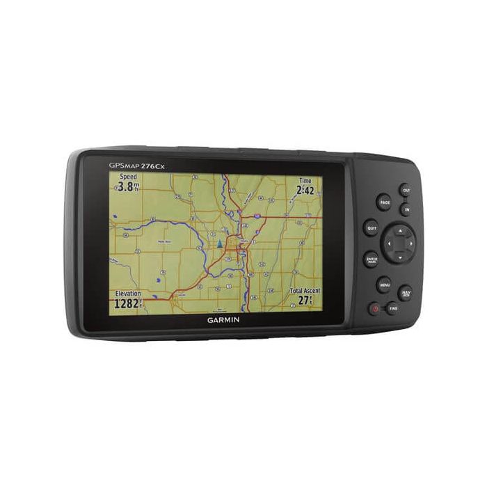
Tough and Ready
GPSMAP 276Cx was designed for your rugged lifestyle. You’ll navigate with confidence by seeing clearly on the large 5-inch sunlight-readable screen. The navigator’s flexible mounting lets you keep the device exactly where you need it. Operate GPSMAP 276Cx with its reliable push-button controls that resist dirt, dust and grit, and best of all –– keep all your maps on hand with 8 GB of internal memory, expandable by a microSD card (sold separately).
More Power Options
Get peace of mind knowing that the GPSMAP 276Cx GPS navigator is going to be ready when you need it, now that there are more ways to power your device. It features in-unit charging with an included lithium-ion battery pack and even has the ability to use standard AA batteries.
| Physical dimensions | 7.5" x 3.7" x 1.7" (191.5 x 94.5 x 44.0 cm) |
| Weight | 15.9 oz (450 g) with included rechargeable pack; 14.6 oz (415 g) with AA batteries (not included) |
| Water Rating | IPX7 |
| Battery Type | rechargeable lithium-ion (included) or 3 AA batteries (not included); NiMH or Lithium recommended |
| Display Type | bright, sunlight readable WVGA display |
| Display Size | 5.0" (127.0 mm) diagonal |
| Display Resolution | 800 x 480 pixels |
| Battery Life | up to 16 hours (lithium-ion); up to 8 hours (AA batteries) |
| Memory/History | 8 GB (6 GB available to use) |
| High-Sensitivity Receiver | Yes |
| Interface | high-speed USB and NMEA 0183 compatible |
| Basemap | Yes |
| Ability to Add Maps | Yes |
| Accepts Data Cards | microSD card (not included) |
| Custom POIs | Yes |
| Waypoints/Favorites/Locations | 10 |
| Routes | 250 |
| Track Log | 20,000 points, 250 saved tracks |
| Free Shipping | No |
|---|