In order to use this website you need to accept the use of Cookies , our Privacy Policy , and our Terms and Conditions.
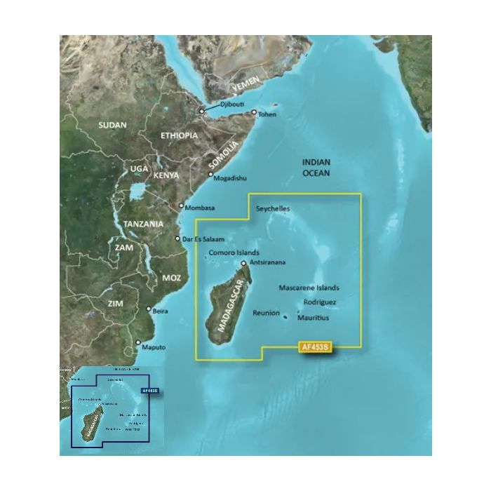
Garmin Mascarene Plateau and Madagascar Charts
R5,709.00
SKU
010-C1152-00
Depth Range Shading Detailed Contours Aerial Photography


Description
When using the Garmin Mascarene Plateau and Madagascar Charts, you get the whole marine chart list for Mascarene Plateau and Madagascar.
This chartplotter features high resolution relief shading which combines colour and shadow to give you an easy-to-interpret view of the bottom sea profile, which makes it easy to find artificial reefs, underwater shelves and much more.
With the detailed contours you are given a more accurate depiction of the bottom sea structure for improved fishing charts and enhanced detail in swamps, canals and port plans. The Garmin Mascarene Plateau and Madagascar Charts also features marinerEye view, which is a 3-D represention of the ocean floor as seen from below the waterline.
We all like to see the real thing sometimes, thats why this chartplotter features high resolution satellite imagery. Which gives you a realistic view of your surroundings so you can navigate with a clear moving chart representation of your boat's position. Which is Garmins most realistic charting display Is a chartplotter
Features
- Auto Guidance
- High Resolution Relief Shading
- Depth Range Shading
- Detailed Contours
- Aerial Photography
- MarinerEye View
- FishEye View
- High-resolution Satellite Imagery
Specifications
| Brand | Garmin |
| Type | Marine Charts |
| Place | Mascarene Plateau / Madagascar |
| Free Shipping | No |
|---|
Write Your Own Review
Customer Questions